Check Out This Stunning—And Stunningly Cold—NASA Photo Of The Great Lakes
By Chuck Sudo in News on Jan 23, 2013 2:45PM
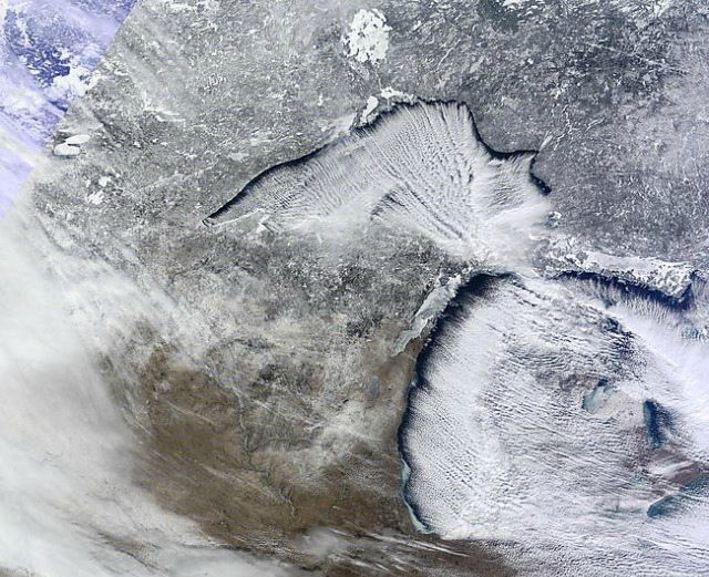
Photo via NASA's Moderate Resolution Imaging Spectroradiometer (MODIS)
This week the Chicago area has seen the coldest temperatures in two years and while it hasn't resulted in snow to the area—Chicago's record streak of days without an inch of recorded snow now stands at 334—the Arctic air rolling through the area has given us this stunning image of the Great Lakes taken from NASA's Moderate Resolution Imaging Spectroradiometer (MODIS), via the Cooperative Institute for Meteorological Satellite Studies at the University of Wisconsin-Madison.
Here's what WGN-TV meteorologist Tom Skilling has to say about the image:
What's amazing about this image from CIMSS at the University of Wisconsin-Madison is its stunning resolution and the clarity with which Tuesday's lake-effect clouds, the ice formation over western Lake Michigan and both the snowpack and array of ice-covered lakes to our north are visible!
This is one of the most beautiful satellite photos we've seen in a while, yet none of that Arctic air has resulted in snow, however. Is it climate change? Or is it just a freaky weather pattern? Who knows.