Sailing The Great Lakes' Not So Free Seas
By JoshMogerman in News on Mar 31, 2013 8:00PM
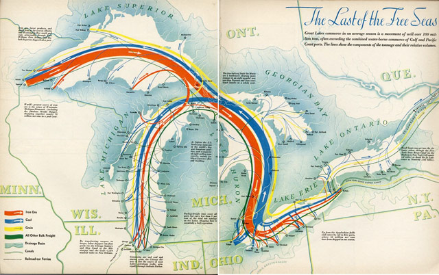
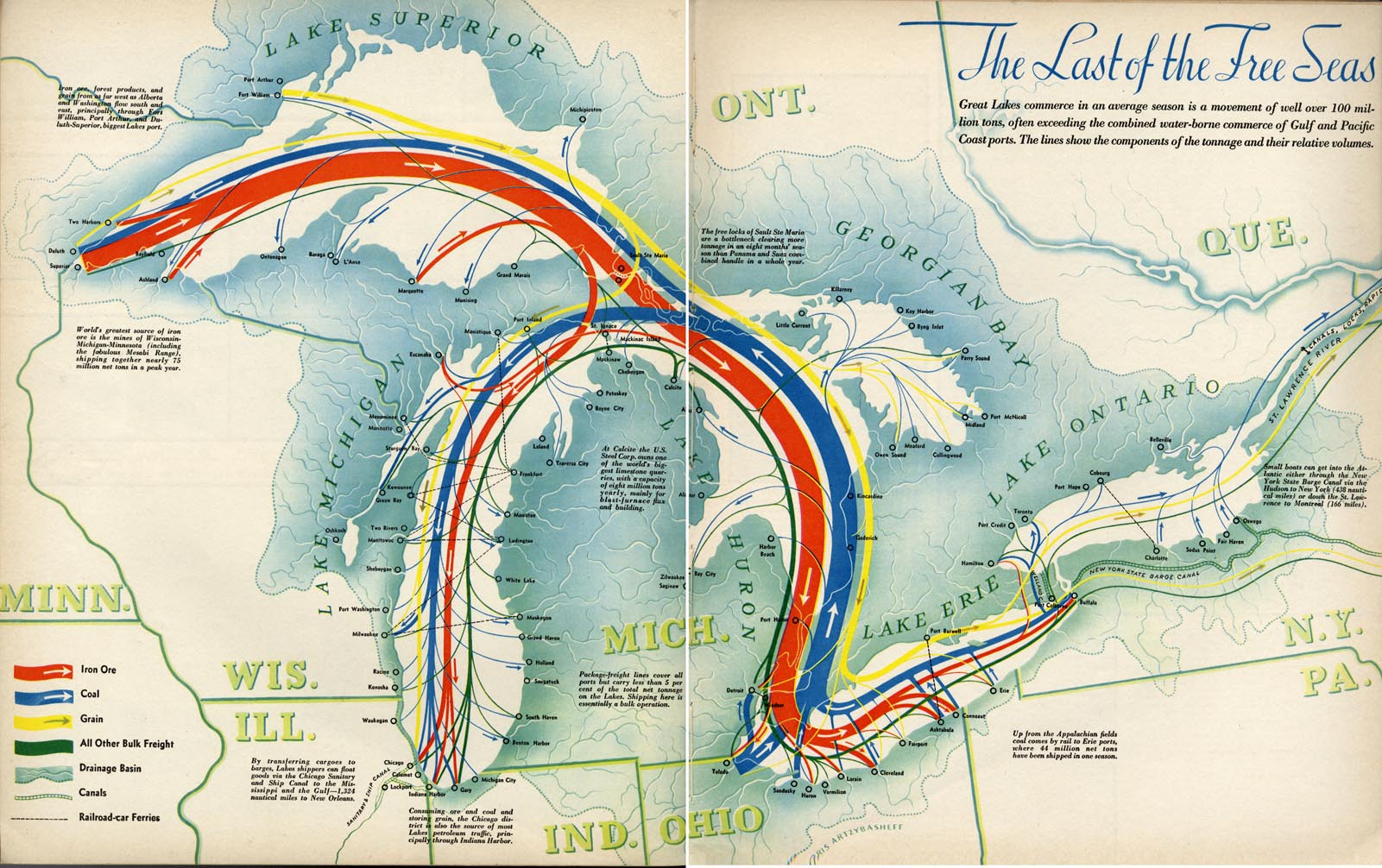
This great “Last of the Free Seas” commerce map from 1940 posted on Dr. Chris Mullen’s “Visual Telling of Stories” blog is a reminder of just how rough things are on the Great Lakes right now. The pre-World War II map notes, “Great Lakes commerce in an average season is a movement of well over 100 million tons, often exceeding the combined water-borne commerce of Gulf and Pacific Coast ports.” These days, Lakers (the boats plying our freshwater seas, not Kobe and Metta) move twice that amount, but as the shipping season is set to open for 2013, the business is getting trickier due in part to climate change.
Lake Michigan has nudged up from its historic low levels, but the Lakes are still about two feet lower than normal this year. That plays havoc on the giant ships sliding into the region’s sandy harbors. These days, low water levels mean ships have to take drastic measures to avoid running aground. Mostly, that means carrying lighter loads—15% on average—which can translate into 10,000 tons less cargo on each run. Making matters worse, Circle of Blue noted that shallower waters are rotting out port structures while climate-induced violent rainstorms are likely washing more silt into ports, making it even trickier for the big boats to dock (which is probably part of the reason Michigan is popping for an extra $21 million in emergency dredging this week).
These days, the Great Lakes are looking like anything but free seas…