Interactive Smithsonian Map Shows Chicago's Growth Before The Great Fire
By Chuck Sudo in News on Aug 28, 2013 5:50PM
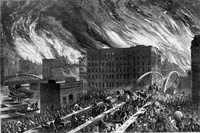
John R. Chapin's famous sketch of the Great Chicago Fire, originally printed in Harper's Weekly.
Smithsonian magazine has a neat interactive map showing how Chicago was in full-on boomtown mode prior to the 1871 Great Chicago Fire.
The magazine uses a current map of downtown and, using a viewfinder, places an 1868 map by publisher Rufus Blanchard over the areas you can scroll over. David Rumsey, the private collector who owns the 1868 map, explains it shows how the city’s early settlers used their ingenuity to transform Chicago into a major rail hub, build the city both west into the outlying areas and east into Lake Michigan.
“Chicago did grow to the east, because it filled [Lake Michigan] in. That’s one thing that’s really exciting about this map. Put the lens on the shoreline and you’ll see how much land was added compared to the old map,” Rumsey explains. To facilitate their booming population, the city used Lake Michigan to its advantage in many ways, from filling in shoreline to create more land to the “Lake Tunnel” and “Tunnel crib,” shown in the upper-right part of the map, which were used to channel fresh water from the lake back to the city.
Rumsey also notes the huge swaths of the city razed by the fire, indicated by the pink and green to the north and yellow and blue to the south. This is your afternoon time suck, folks.