Check Out This Very Busy Map Of Immigration Trends From 1903
By Chuck Sudo in News on Oct 23, 2014 7:45PM
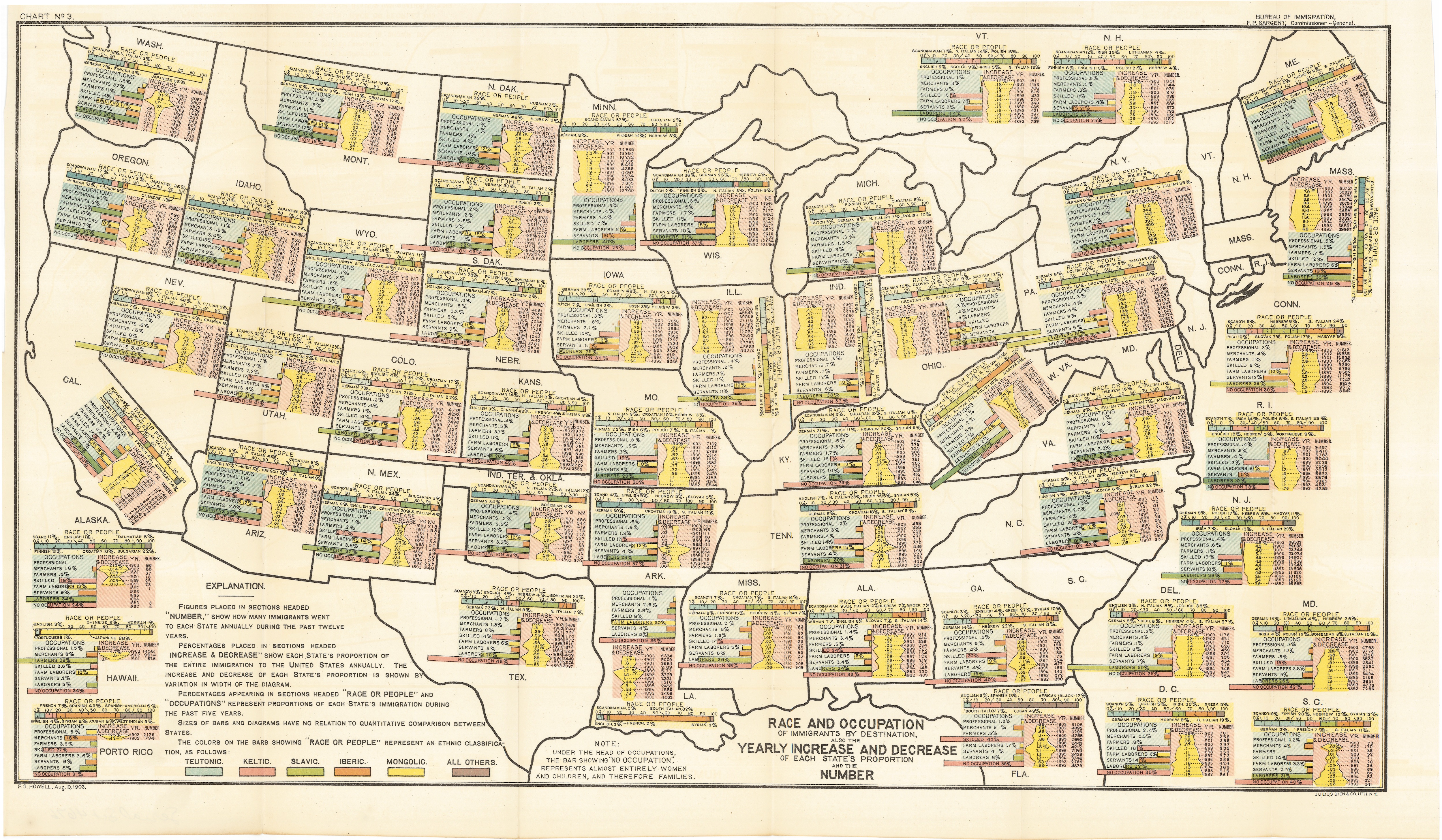
Cartography certainly has come a long way over the centuries when it was believed the earth was flat.This map from 1903 titled "Race and Occupation of Immigrants by Destination" was an early attempt to do with maps what applications like Google Maps can easily do today. The mapmakers breaks down the ethnic demographics of each state in the union at the time by quasi-scientific terminology of groups based on ethnicity, race and occupations, as well as the changes in those breakdowns on an annual basis. The map was commissioned by the Commission-General of Immigration and printed by the Government Printing Office. (Click on the image below to enlarge; to read Illinois' breakdowns, click on Illinois before enlarging.)
[John Ptak's Ptak Science Blog, via Slate, h/t Gapers Block]