Googling Chicago
By Chris Karr in Miscellaneous on Jul 11, 2005 2:48PM
A few years ago, Chicagoist wrote a thesis on how Geographic Information Systems (GIS) technology could change the way people work and play. While the thesis was largely speculative at the time and only produced a few workable prototypes, Chicagoist was excited this last week to discover that one of the world's coolest companies has taken the ball and run with it.
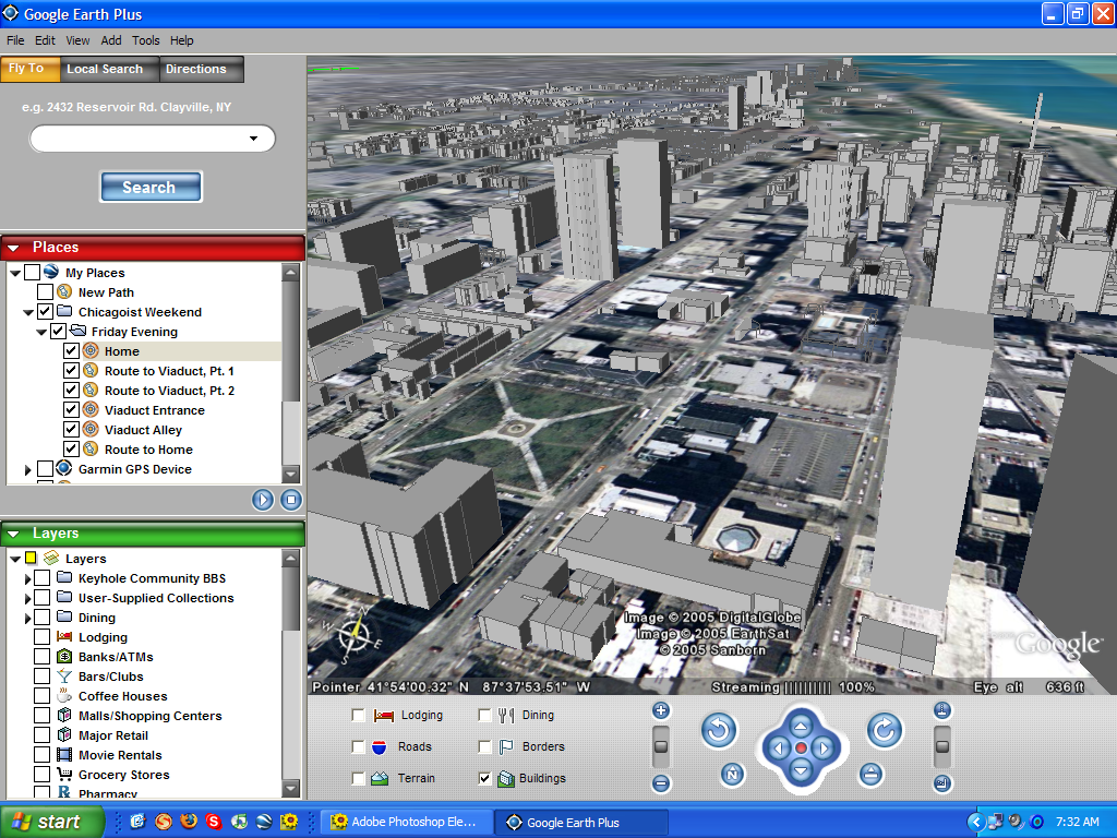
Google Earth is the latest of free services offered by the search engine titan Google. While Chicagoist instantly fell in love with the satellite photos available in Google Maps, Google Earth makes Google Maps look like that girl you see at your high school reunion who makes you wonder, "I got all bent out of shape about her?" while sipping a martini with your new wife who speaks six languages, runs the marathon, and models underwear on the side. While Google Earth is Windows-only, it is one of those killer apps that all Chicago residents should own.
More below the fold...
Unlike its sister services, Google Earth is a standalone application that can be downloaded for free. The free version gets you worldwide satellite photography coverage, streets and roads in the United States and abroad, and a built-in yellow pages for finding businesses and services in your area. While Chicagoist is impressed that Google Earth can find the house in West Texas where we lived during the sixth grade, Google Earth really shines in metropolitan areas like Chicago.
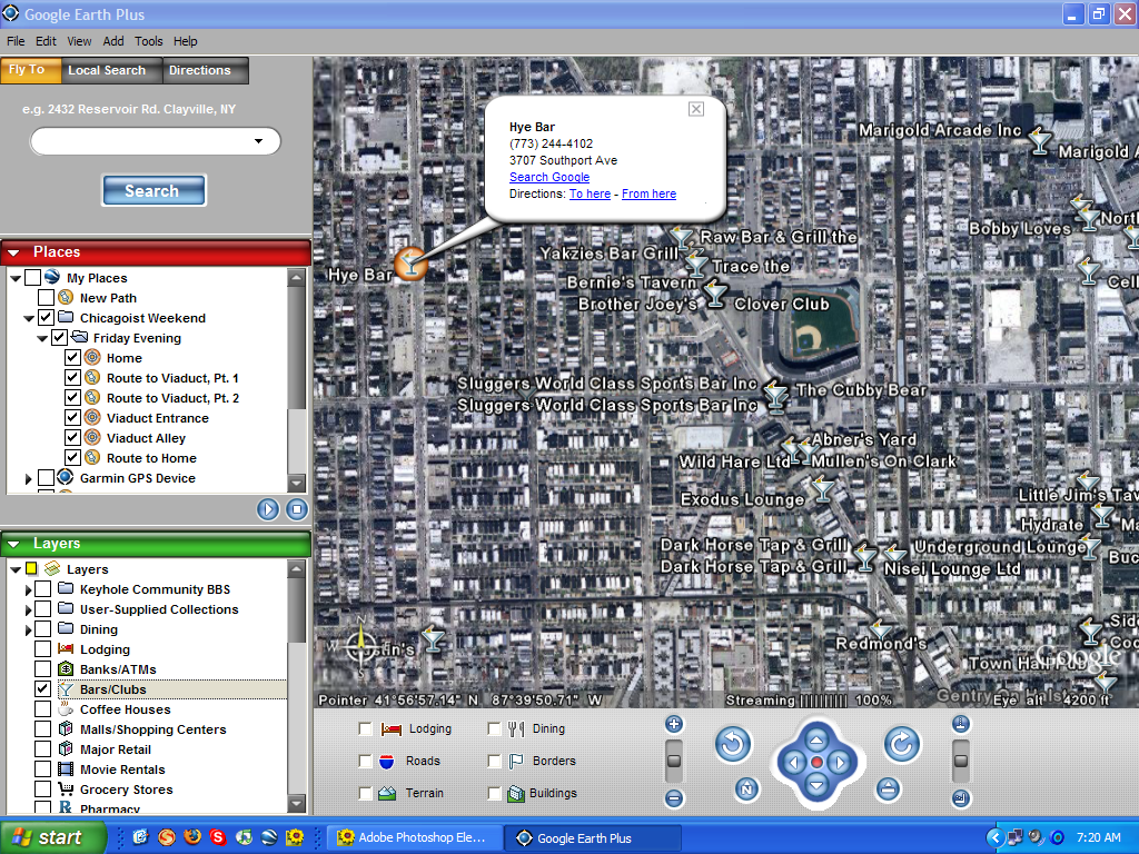
First of all, Google Earth includes an updated list of bars and dining establishments in the area being viewed. While the number of pubs in Wrigleyville is overwhelming from too high of a viewing altitude, it is nice to type in a home or work address and see all the places that are overlooked. In addition to bars and restaurants, Google Earth includes banks, coffee houses, movie theaters, and everything else that can be overlaid on a bird's eye view of the city. Furthermore, by tapping into the Google Maps database, Google Earth not only tells you where where your favorite mall or tavern is - it also will give you driving directions.
For the true geography geeks out there, Google Earth also features enhanced functionality that can be unlocked for a twenty dollar fee - including integration with global positioning system devices (GPS). Chicagoist made a geo-log of the places visited this weekend, but we will not be posting it due to the embarrassment of walking to a place around the Sedgwick stop and ending up in Wicker Park. (Chicagoist now yearns for a version of Google Earth that runs on our cell phone.) However, in the spirit of user-contributed content, Chicago's local Prudential realtors cooked up a plugin that will allow prospective homeowners to see the currently available properties, with photos and prices. Being a geo-geek ourselves, Chicagoist took a look at the technology and expects to see a flood of personal geographic weblogs, online tours of the city, and geographic recommendations. Maybe an astute reader will put together a geographic guide to the local places to visit and the local places to avoid when trying to woo a prospective mate. (Hint, hint.)
We could go on and on about this new application, but words don't do it justice. Download the application and check out all those places you never knew you existed in this grand city of ours.