A Look Back at Chicago's Rail Maps
By Kevin Robinson in Miscellaneous on Dec 1, 2009 6:00PM
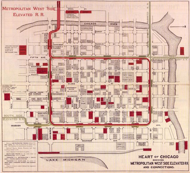
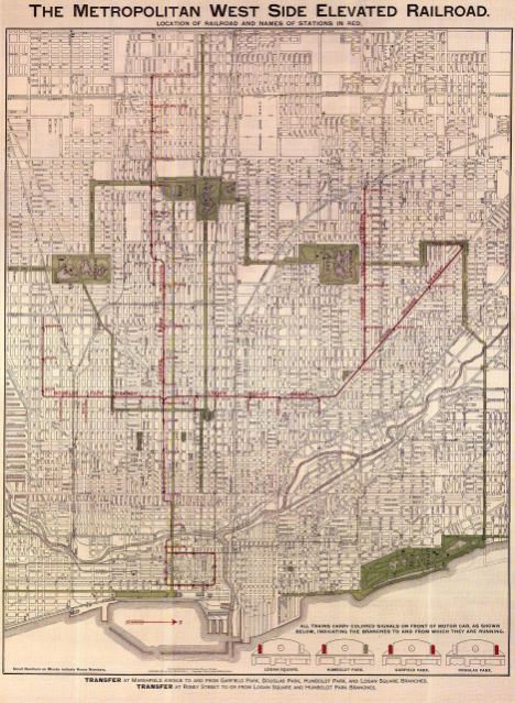
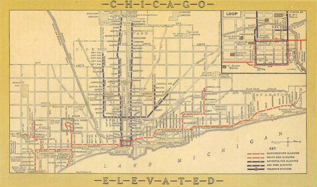
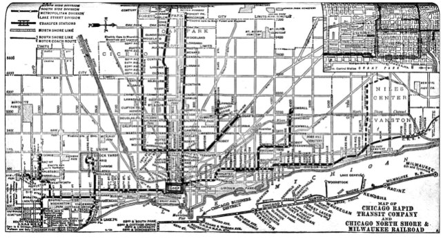
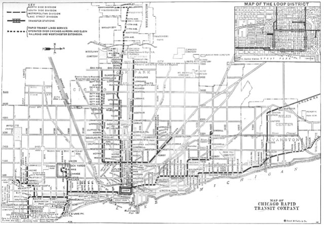
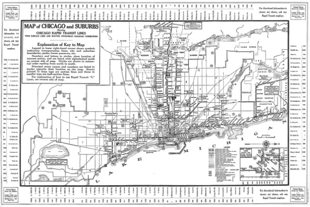
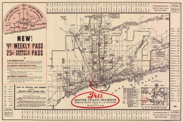
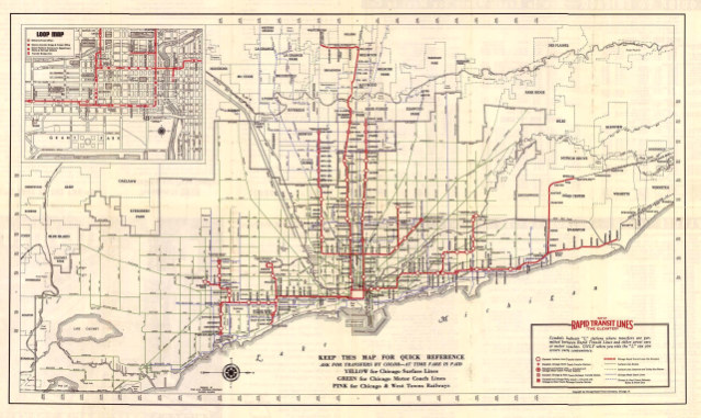
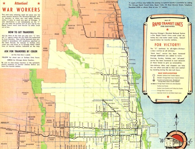
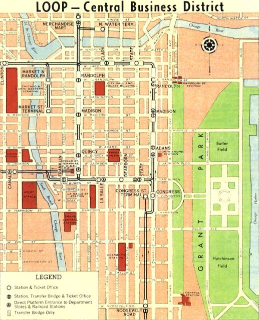
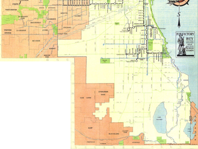
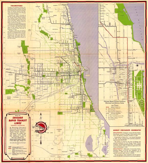
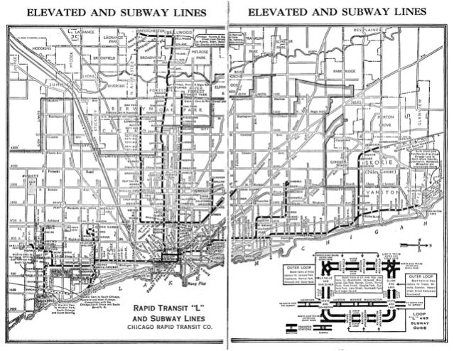
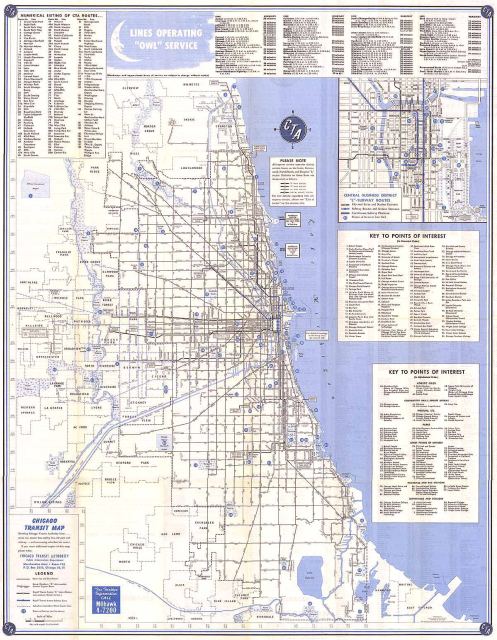
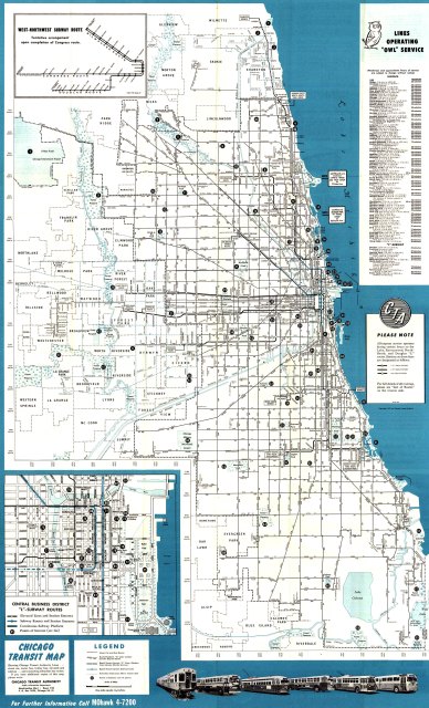
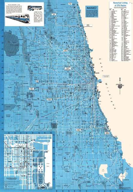
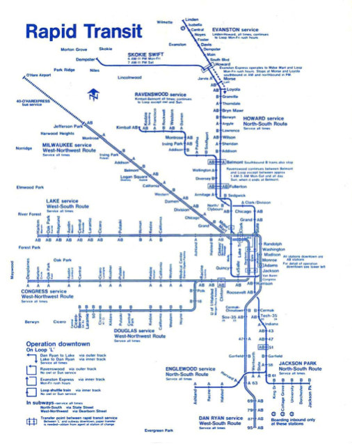
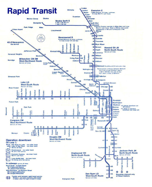
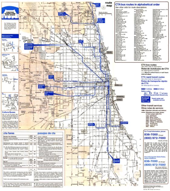
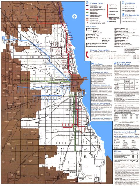
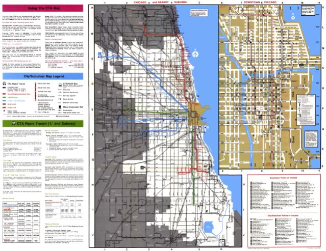
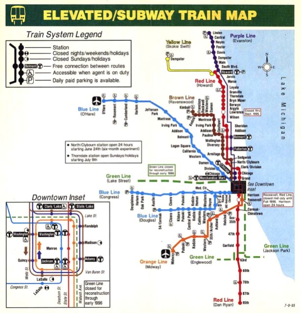
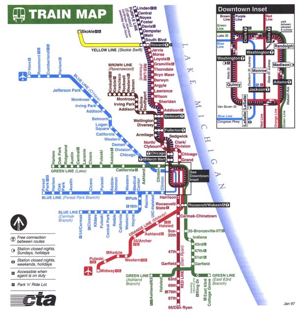
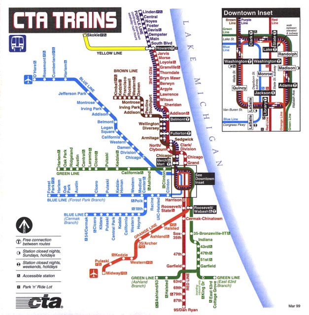


If you've ever looked out the window of the El and wondered what Chicago looked like 25, 50, even 100 years ago, you've no doubt wondered what it would be like to ride the CTA back then as well. In fact, Chicago's elevated train system is one of the oldest in the nation - only New York has an older system, beating us into operation by only a few years. Thanks to the good folks at Chicago-L.org, you can examine, up close and in detail, many versions of old system maps, going back to the late 1800's. So break out the Algren and put on an old-timey movie: we're taking a trip back in time, courtesy of the Chicago L! [via]