NASA Images Show Cairo Flooding Before and After Levee Breach
By Chuck Sudo in News on May 11, 2011 6:00PM
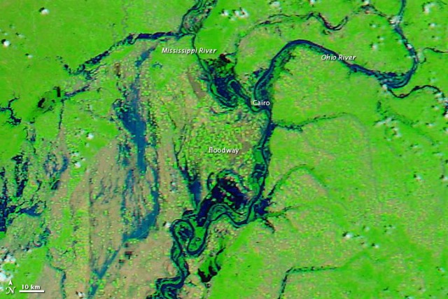
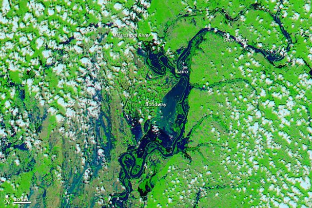
Take a look at these amazing before-and-after shots from NASA's AQUA satellite of downstate Cairo before and after the Army Corps of Engineers blew up the Birds Point Levee in Mississippi County, MO to prevent further flooding.
The satellite uses a combination of visible and infrared light to increase contrast between water and land. Water ranges in color from electric blue to navy. Vegetation is green. Clouds are pale blue-green and cast shadows onto the land surface below. Per NASA:
Tiny squares of green in the April 29 image show that the floodway consists of farmland. The image from April 29 also shows flooded conditions along the Ohio and Mississippi Rivers. In the image acquired on May 3, the floodway downstream of Cairo is submerged.
The Aqua Satellite also captured the extent of the flooding currently happening in Memphis, TN.