CityMaps Launches In Chicago
By Chuck Sudo in Arts & Entertainment on Jun 25, 2012 7:00PM
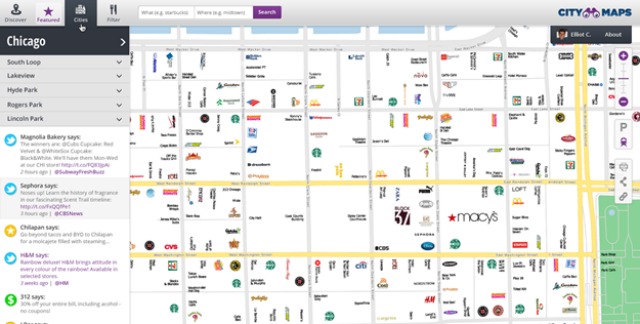
CityMaps, a web and iPhone-based app that takes social media APIs to create interactive maps of what's happening in a specific area, launched a Chicago map today.
CityMaps uses business names and logos as reference points for where a user is in the city, then shows what daily deals are happening around them. Tweets from local businesses, daily deals, Foursquare tips, OpenTable reservations, Fandango showtimes and movie trailers can all be seen on CityMaps at a glance. Plus you get to see where all those hidden Bank of America and Starbuck's branches are located.
We spent a good part of this morning toying around with CityMap's Chicago layout and, as is often the case with these launches, were woefully underwhelmed by their city borders. So far they've stuck with with the usual locations apps like these tend to focus, which makes CityMaps more of a tourist resource than anything. CityMaps' Christopher Winfield said via email this was only the beginning. "We started with the most business dense areas and are moving outward and into the suburbs."
As for whether CityMaps can help its users find local landmarks, that's another matter. From what we've found, finding actual local landmarks takes a back seat to the deluge of social media marketing and the shops listed on the maps.
CityMaps' maps are so cluttered with business logos and other ephemera that actual landmarks like the Chicago Water Tower and Fourth Presbyterian Church—using the Mag Mile as a reference—get lost in the shuffle. Water Tower Place, conversely, is annotated with its unmistakable logo. If you're the person for whom a shopping mall is a landmark, then CityMaps is for you.