Check Out This Renaissance-Influenced Map Of Chicago
By Chuck Sudo in Arts & Entertainment on Feb 19, 2014 4:15PM
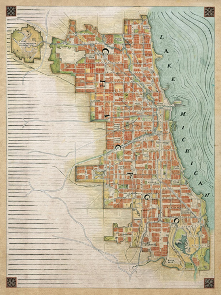
Check out the latest Chicago-centric map from Phil Thompson of Cape Horn Illustration: a “Renaissance” map of the city.
Thompson told Chicagoist he worked on the main map, roads and lettering over a three-month period, exclusively using pen and ink. “The main streets and city outline stay faithful to the true city, but I took some artistic license with the tiny roads--people might not want to use this to get around their neighborhoods,” Thompson said.
Here’s where the Renaissance influence enters. “The color palette is based off of German maps of European towns from the 1500-1600s,” Thompson said. “Overall, the effect I was going for was the feel of those old walled-in towns with a lot less known about the outside world, and a little bit of the old world ornamentation.”
Thompson has fast become a favorite mapmaker around the Chicagoist offices. Cape Horn Illustration also produced a map of the Chicago Marathon course from a runner’s point-of-view; the “Chicago Currents” map featuring a sea monster slithering up to a ship on Lake Michigan; and the Chicago Beer Bars map. Thompson’s latest entry is worthy of inclusion among those.
Thompson said the map will be available for sale in March and is now taking pre-orders on Cape Horn Illustration’s website.