Another Derecho (Or At Least A Lot Of Rain) Is Heading Our Way
By Chuck Sudo in News on Jul 21, 2014 9:00PM
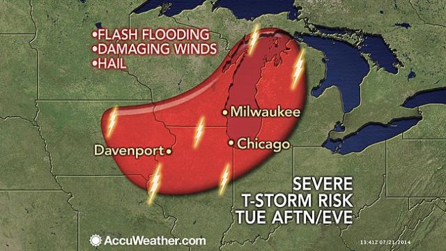
Image via Accuweather.
We know the sun, heat and humidity will stick (in the latter case, literally) through Tuesday afternoon. Come time for tomorrow’s evening rush, however, we’re in store for more severe weather in the form of thunderstorms.
The thunderstorms are expected to develop in the afternoon as the result of a derecho that will hit north of us, from the Dakotas to the Twin Cities this afternoon through early Tuesday. A derecho, as explained by the Storm Prediction Center, contains damaging winds across a width of at least 240 miles. It can also produce heavy rains, hail and cause heavy flooding to area waterways. We just weathered a double derecho a few weeks back.
Once the derecho passes through Minnesota is will send the thunderstorms south and east. In addition to Chicago, Milwaukee, Green Bay and Madison, Wisc., along with Davenport and Waterloo, Iowa, will be affected. But Accuweather predicts the heaviest hit cities will be Milwaukee and Chicago. The heat and humidity currently in the area will also be contributing factors.
Once the storms pass we’ll be back to the unusually mild 70-degree temperatures we’ve been enjoying around here for much of the summer, with a shot at 80-degree readings Saturday and Sunday.