This Historic Map Shows The Great Chicago Fire Of 1871's Reach
By Rachel Cromidas in News on Oct 8, 2015 4:50PM
It's the anniversary of the Great Chicago Fire of 1871—the historic blaze that ravaged parts of the city and, decades later, became a symbol of Chicago's tenacity and rebirth.
The fire burned for nearly two days from Oct. 8 to Oct. 10, killing hundreds and destroying a little over 3 square miles of the city, mostly centered in the city's downtown business district. The fire reportedly left 100,000 homeless and the city and though a relief effort was quickly underway, it took years for the city to recover.
These days, the fire has inspired an annual festival, a university mascot, and the name of a local tech incubator, among others.
To mark the occasion, the Newberry Library has shared this historic map depicting the effects of the blaze on its Facebook page, in a map labelling the city's so-called "Burnt District." Check it out, history buffs:
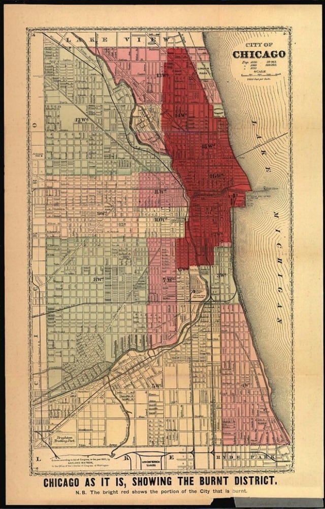
"#onthisday in 1871 the #GreatChicagoFire started, raging northward for 36 hours and destroying 3.5 square miles of the city. Published the same year as the fire, this map shows the extent of its destruction. The southern-most border of the "burnt district" is DeKoven Street--the site of the O'Leary's infamous barn." via Newberry Library