Check Out This Map Of Settlement Patterns In Chicago In 1950
By Chuck Sudo in News on Jan 14, 2015 3:55PM
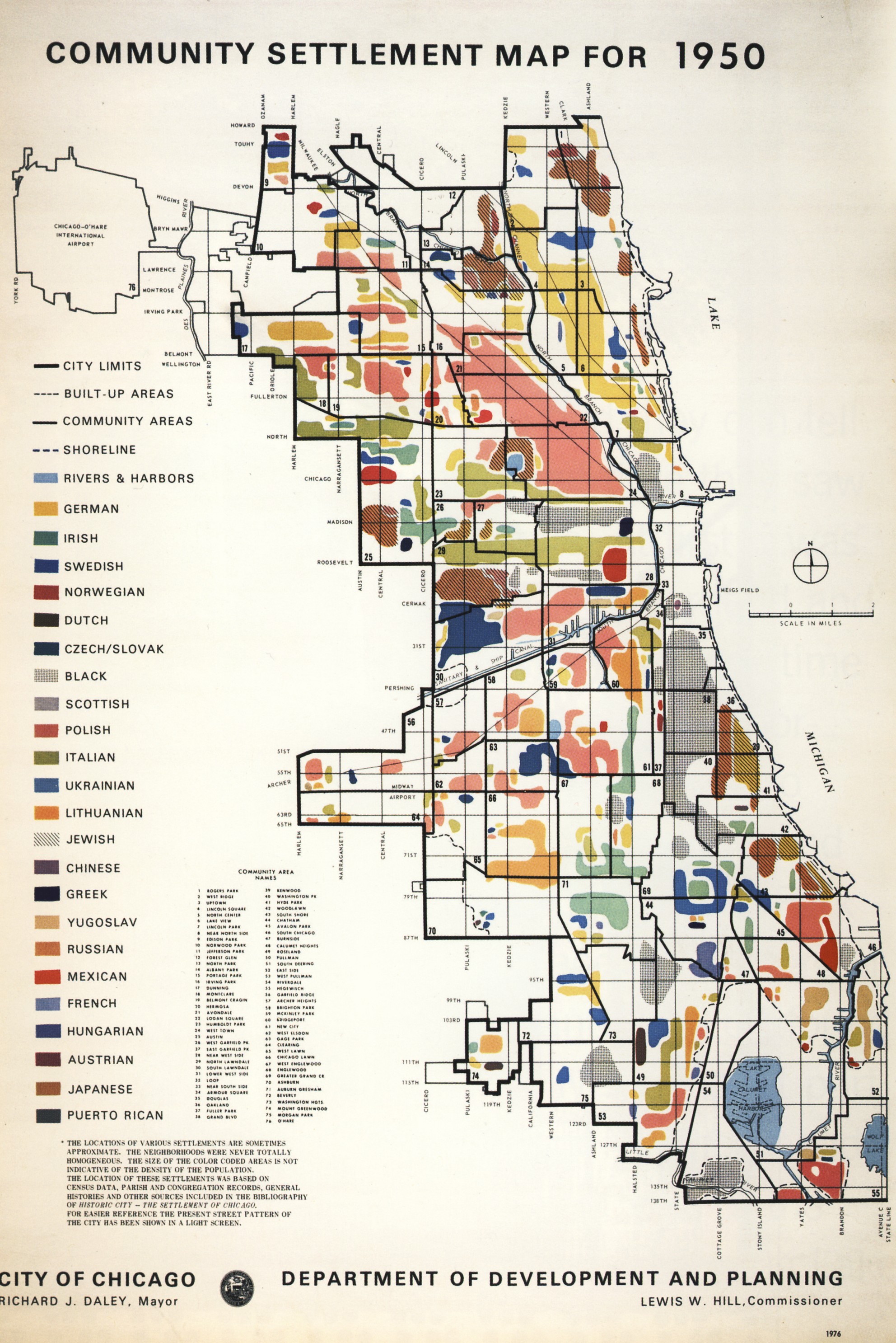
We noticed this cool map of Chicago settlements in 1950 on Reddit, which shows where different ethnic groups settled in the Second City. But we had to do some research on the map after some details about it seemed off.
Let's start with the year at the bottom right hand corner of the map: 1976. Also, the mayor listed on the map is Richard J. Daley, who was mayor in 1976 but wasn't mayor in 1950; Daley didn't take office until 1955.
Take a look at the upper left of the map, by O'Hare International Airport. Notice how its boundaries aren't emboldened? That's because O'Hare wasn't annexed into the city limits until 1956. And the use of the term "black" to describe African-American settlements wasn't common in 1950—the standard nomenclature was "negro."
Seeking answers, we went to the best online resource we know for all things Chicago: Forgotten Chicago. A 2011 thread in their forums reveals this map most likely was printed by the city Department of Development and Planning to highlight Chicago's place in American history during the nation's bicentennial celebrations of the American Revolution. So Daley ordering the Development and Planning Department to reprint historic maps showing Chicago's growth into a ... wait for it ... "world class city." (Click on the map to enlarge.)
Related:
Check Out This Very Busy Map Of Immigration Trends From 1903