The Best Outdoor Runs In Chicago
By Emma G. Gallegos in Arts & Entertainment on Apr 26, 2017 3:45PM
One of the first signs of spring in the Midwest are runners. Once the mercury rises even a smidge, they're out in full force, eager to escape the indoors tracks and treadmills where they'd been trapped all winter. Once the weather isn't so ungodly, Chicago is a great place to train for your next 5K or marathon or anything in between. We've got runs whether you're looking to explore nature or the city—or a nice cross between both. (Looking for a more rugged run? Many options on our best hikes list would work, too.)
THE 606 TRAIL
One of the newest, shiniest trails for runners (sometimes literally) is The 606, a.k.a. the Bloomingdale Trail, a 2.7-mile elevated path from Logan Square to Bucktown with award-winning design. Sometimes you might have to share the trail with police on ATVs, cyclists or slow-walkers. But that's a small price to pay for being literally above traffic on a very well-kept trail that marches right through the city.
HUMBOLDT PARK
Humboldt Park is probably my favorite urban park, sitting on 219 acres in the West Chicago neighborhood of the same name. When puffy cumulus clouds roll in, there are fewer more beautiful places in the city. It has everything you could want in a park: lush landscaping, a meandering prairie river, enough well-maintained paths to make you forget you're in a city, a cute place to grab a post-run sandwich and, best of all, never too many people (well, unless it's festival season).
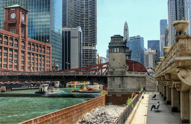
RIVERWALK
Everyone knows the Chicago River is the best way to take in the city's architecture. So it's pretty exciting that Chicago Riverwalk is finally officially open. It's not a long stretch—just 1.3 miles at this point, making it perfect for a lunchtime jog for workers in the Loop. But if you're looking for a longer run, you could tack this onto another route. Perhaps the nearby Lakefront Trail or Grant Park? Be warned you may also run into amblers on their way to boozing in domes or eating. The opening for the season this year is May 20.
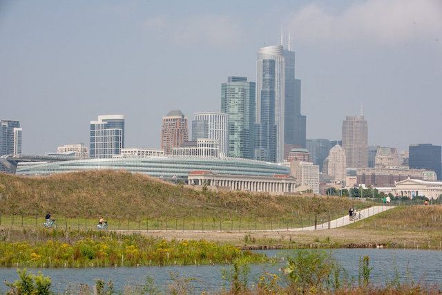
NORTHERLY ISLAND PARK
Northerly Island Park, one of the city's newest parks, is on a manmade peninsula that juts out into Lake Michigan and runs parallel to Museum Campus. It spent the better part of the decade as a single-runway airport but today it has been restored to become what Daniel Burnham always hoped it would be: a park for the public to enjoy. Though it is literally almost within the shadow of the Loop, the city has worked hard to make the Nature Area feel like a slice of the prairie. There is about half-mile walk to get down to the Nature Area, and once you're there there is a mile-long trail that loops around. (Warning: the eastern edge of the trail was washed out during spring storms, so you won't be able to do a full loop until that is repaired. Call the Fieldhouse to check on the status before you go.)
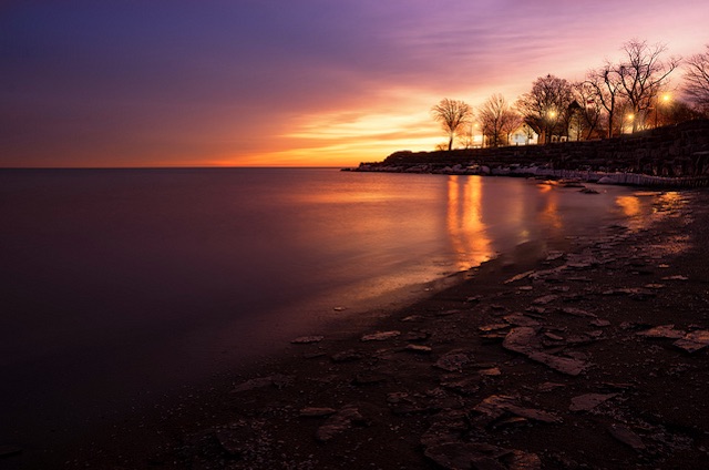
Promontory Point off the Lakefront Trail (Photo by Brian Koprowski via the Chicagoist Featured Photos pool on Flickr)
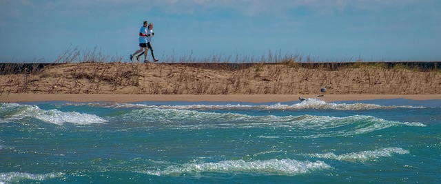
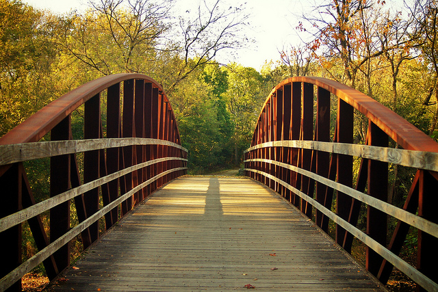
LAKEFRONT TRAIL
The Lakefront Trail may be popular but it's not overrated. You're not going to find a better route protected from cars that cuts through so many Chicago neighborhoods—about 18 miles all the way from Edgewater to the South Shore. The stretch from Museum Campus to Grant Park to Lincoln Park is the busiest (and most touristy). It boasts the hopping North Avenue Beach, up-close views of the skyline and lots of folks on bikes and Divvys and rollerblades. If you'd like to avoid the crowds and have a peaceful lakefront run, head south. Scoot out to Promontory Point at 55th Street to gaze back at the skyline in the distance. And towards the southern end of the trail, there's Jackson Park, which is a bit wild and woolly for a park that's right in the middle of the city. But if you need some wilderness in your life, meander around the lagoons and meadows. You'll still find remnants of the 1893 World's Columbian Exposition, designed by Frederick Olmsted and Daniel Burnham, like the Osaka Japanese Garden on the Wooded Island. The island, once a respite from the crowds of the White City, is home to some prime bird-watching in early fall.
WASHINGTON PARK
Washington Park is one of the historic parks in the South Park System designed by Frederick Law Olmsted and Calvert Vaux at the end of the 19th Century. Once upon a time, sheep roamed the meadows, keeping them well-trimmed for baseball players. (It was also to be the site of Chicago's failed 2016 Olympics bid.) It's currently one of the larger parks in the city at 366 acres, and it is an excellent place to run in a loop. The south end of the park has a lagoon with a small island that you can cross on your jog. Should you want to lengthen your run, pass Lorado Taft's Fountain of Time and onto the Midway Plaisance that connects to Jackson Park.
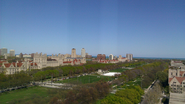
Looking down at the Midway Plaisance from atop the Logan Center for the Arts (Photo by Elizabeth via the Creative Commons on Flickr)
CHICAGO'S PARK AND BOULEVARD SYSTEM
Long distance runners in Chicago are fortunate, in that there are so many ways to go for a lengthy run without having to competing with cars or street signals. That being said, there will be days where you don't want to hop into a train, bus or car before you start your run; you just want to lace up your shoes and head out the door for a run on the streets near your home. Chicago's historic park and boulevard system can make this awfully convenient for Chicagoans who live in outer neighborhoods, whether on the North, South or West sides.
You can run in a nearly unbroken line from Logan Square Park to Gage Park, east on Garfield Boulevard to Washington Park, the Midway Plaisance and then Jackson Park, where you'd link up with the Lakefront Trail. (There are a couple of other offshoots of the boulevard system, including Dr. Martin Luther King Drive, which was once named Grand Boulevard.) Some of the other parks this route cuts through include Palmer Park, the aforementioned Humboldt Park, Garfield Park, Douglas Park, McKinley Park and Sherman Park. The beauty of Chicago's historic boulevard system is that on this route you'll pretty much always be running in a park or on a green, leafy median. Another pro to runs along this route is there are many beautiful and historically significant homes and buildings along the way. Chances are you might want to stick close to home and stick to your local parks, but if you ran the whole system, you could say you ran a marathon.
Des Plaines River Trail in Lake County Forest Preserve (Photo by jonathan hartsaw via the Creative Commons on Flickr)
DES PLAINES RIVER TRAIL
This is a little more rugged than some of the other runs, but if you really want to feel like you're getting away without heading too far, the Des Plaines River Trail is a good option. The trail begins in the Jerome Huppert Words in River Forest (just west of Oak Park), and it follows the Des Plaines River from Cook County to Lake County all the way up to Wadsworth, near the border of Wisconsin. In Cook County, it's mostly a dirt path. Avoid it after storms, unless you're a fan of mud runs. (Check this Facebook group for recent reports from bikers.) The path evens out and is more consistently paved with crushed gravel once you cross into the 31-mile Lake County stretch. It's not usually too crowded, but be warned you'll be sharing the road with bikers and even horses. Like a lot of the region's riverside trails, this is an especially nice place to be when the leaves change.
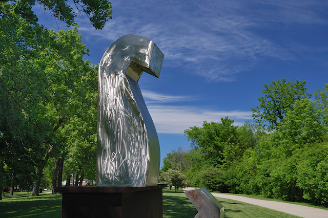
The path runs along Skokie Sculpture Park (Photo by Carmen B via the Chicagoist Featured Photos pool on Flickr)
NORTH SHORE CHANNEL TRAIL
Another option if you want to run along water is the North Shore Channel Trail that starts at Chicago's northern border. The route is paved with either crushed limestone or asphalt along the way. The trail follows namesake channel through several parks along the way, including the Skokie Northshore Sculpture Park. The trail stops in Evanston at Green Bay Road just a little short of where the channel empties out into the Lake. The route one direction is nearly 7 miles.